

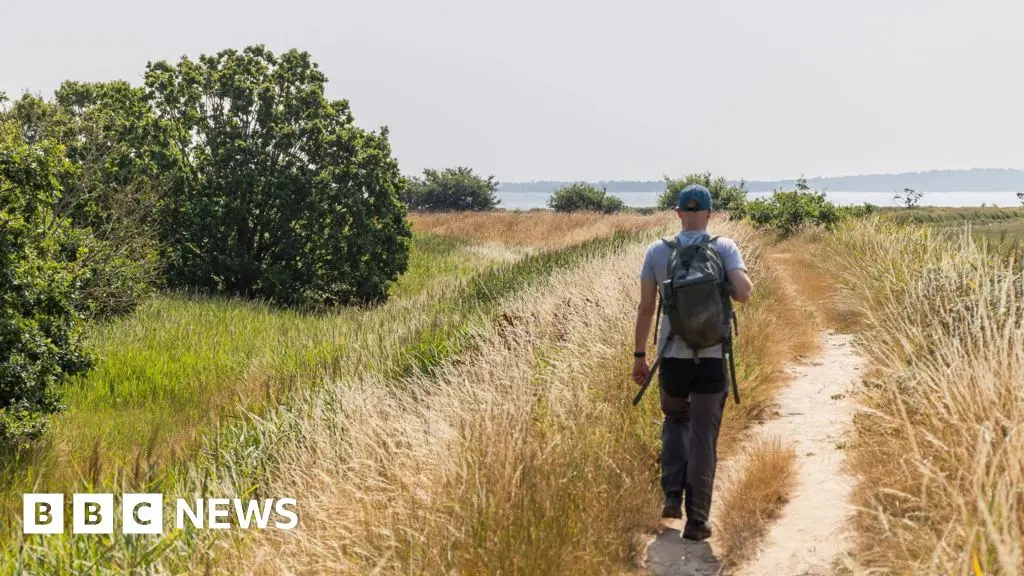
A significant milestone in the development of the King Charles III England Coast Path has been reached with the official opening of a new 13-mile (21km) section along the Suffolk side of the River Stour. This stretch, running from Cattawade to Shotley Gate, unlocks previously inaccessible land and connects to an existing path that continues to Southwold, bringing walkers closer than ever to the full realization of a 2,700-mile national trail encircling the English coast.
Unlocking Access to Suffolk's Estuary
The newly opened route begins at the White Bridge in Cattawade and winds through a series of picturesque villages and landscapes: Brantham, Stutton, Lower Holbrook, Harkstead, and finally Shotley Gate. Many sections were previously closed to the public or required long detours, but the path now offers uninterrupted coastal access along one of Suffolk's most beautiful estuaries. The River Stour estuary is a designated Site of Special Scientific Interest (SSSI) and an internationally important wintering ground for birds such as black-tailed godwits and dark-bellied brent geese. Walkers can expect to see these species alongside a rich diversity of plant and animal life.
Historical and Industrial Heritage
The route is steeped in history. One of its most notable landmarks is the remains of the Xylonite plastics factory at Brantham, the first commercial plastics factory in Britain. This site, which operated from the late 19th century, produced early plastic materials and played a key role in the Industrial Revolution. A short detour leads to St Mary's Church at Erwarton, reputedly where the heart of Anne Boleyn was buried in 1536. The path also passes near the Royal Hospital School in Holbrook, a historic boarding school founded in 1712 that originally trained boys for the Royal Navy.
The meandering course of the River Stour has inspired artists and writers for centuries, including John Constable, who painted its scenery. Today, the new path allows visitors to experience the same vistas that inspired his works, such as the sweeping bay at Holbrook and the tranquil reaches at Stutton Ness.
Coastal Erosion and Path Design
Climate change and coastal erosion have necessitated careful route planning. At Stutton Ness, the path has been moved away from the receding cliff edge to ensure safety while preserving views. Natural England, the government agency responsible for the project, has collaborated with Suffolk County Council and local landowners to create a sustainable trail that can adapt to changing conditions. This section is part of a broader effort to provide long-term, resilient access along England's entire coastline.
Hannah Thacker, Area Manager for Natural England, emphasized the significance of the opening: 'This trail creates new sections of access on 4.5 miles, enabling people to walk along one of the county's most beautiful estuaries. It means walkers can now enjoy more of Suffolk's stunning coastline. Opening during the summer holidays, it's a great day out for families, with regular bus services running to Shotley Gate from Ipswich.'
Progress Toward a National Trail
The King Charles III England Coast Path, previously known as the England Coast Path, was renamed in honor of King Charles III after his coronation. When complete, it will be the longest continuous coastal walking route in the world, stretching 2,700 miles from the Scottish border to the Welsh border, around the entire English coast. Suffolk has been at the forefront of this project: 120 miles (193km) of the path have already been opened in the county, including sections along the Suffolk Coast and Heaths National Landscape (formerly Area of Outstanding Natural Beauty).
Suffolk county councillor Morgan Brobyn, who oversees the environment and public rights of way, noted: 'There are now just a few miles of the path left to complete in Suffolk, giving residents and visitors access to so much of our county's natural beauty.' The remaining sections are expected to be finalized in the coming years, closing the gap between Felixstowe and Bawdsey and connecting Felixstowe to the existing route near Orford.
Local Communities and Wildlife
The new route passes through several villages that have long sought better access to their own riverfront. In Lower Holbrook, the path runs along the foreshore, offering views across the estuary to the historic town of Harwich. The village of Stutton, with its ancient church and traditional pub, provides a rest stop for walkers. At Harkstead, the path skirts the edge of a nature reserve managed by the Suffolk Wildlife Trust, where reed beds and saltmarshes support breeding birds such as avocets and little terns.
The economic benefits are also significant. Local businesses, including cafes, B&Bs, and shops, are expected to see increased footfall. The path encourages active tourism and helps distribute the economic impact of tourism away from hotspots like Aldeburgh and Southwold, spreading it to lesser-known areas.
Beyond Suffolk, the King Charles III England Coast Path is a flagship project of the government's 25-Year Environment Plan. It aims to connect people with nature, improve physical and mental health, and support the recovery of coastal habitats. Each new section is carefully designed to minimize disturbance to wildlife while maximizing public enjoyment.
As the path continues to grow, it is also fostering a sense of national pride. Along the River Stour, walkers can now trace the route of an ancient trade waterway that once carried goods between Suffolk and the Continent. The new stretch is not just a physical path but also a journey through time, linking the past with a sustainable future.
The section officially opened in August 2024, and early feedback from users has been overwhelmingly positive. With its combination of natural beauty, historical intrigue, and thoughtful design, the King Charles III England Coast Path is proving to be one of the most ambitious and rewarding walking projects ever undertaken in England.
Source: Bbc News